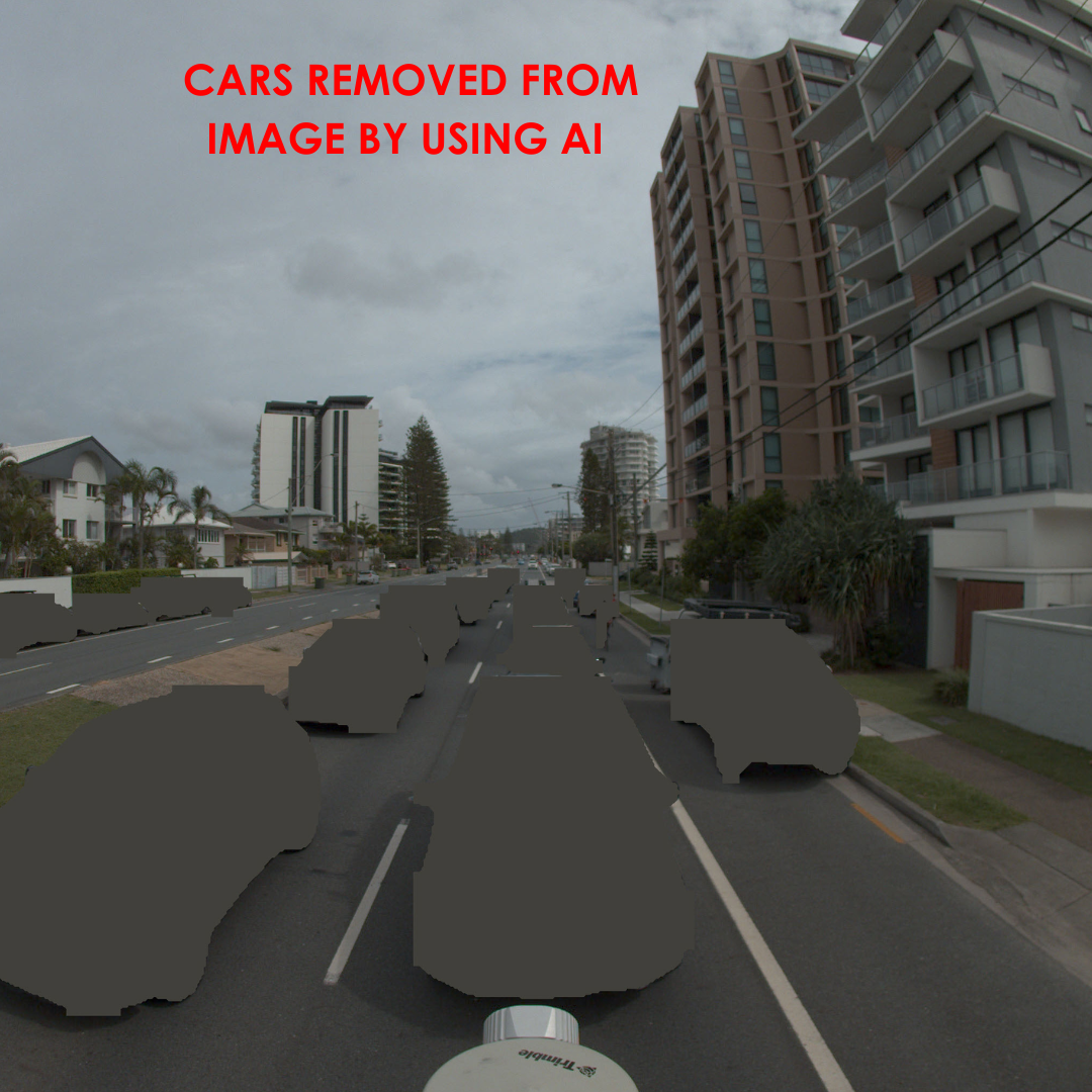
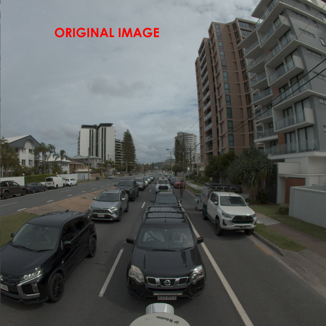
In the Mobile Laser Scanning (MLS) world - especially in dense urban environments - one of the most persistent challenges we face is the presence of parked or moving vehicles next to the MLS device during data capture.
To minimise their impact, we often schedule scanning runs during off-peak hours or at night. Our LiDAR sensors, being active, work regardless of lighting conditions, but our cameras - being passive - require daylight to produce usable imagery. This means cars inevitably show up in the images we use to colourise our point clouds. The result? Car "footprints" appearing as false data on roads, building facades, and other surfaces.
To solve this, we’ve started integrating AI into our workflow - and it’s been a game changer. Here's how:
- Stage 1 – Image Cleanup: We developed custom AI scripts to automatically detect and remove vehicles from each camera frame before they’re used for colourising the point cloud. This ensures we don’t "paint" cars onto nearby structures.
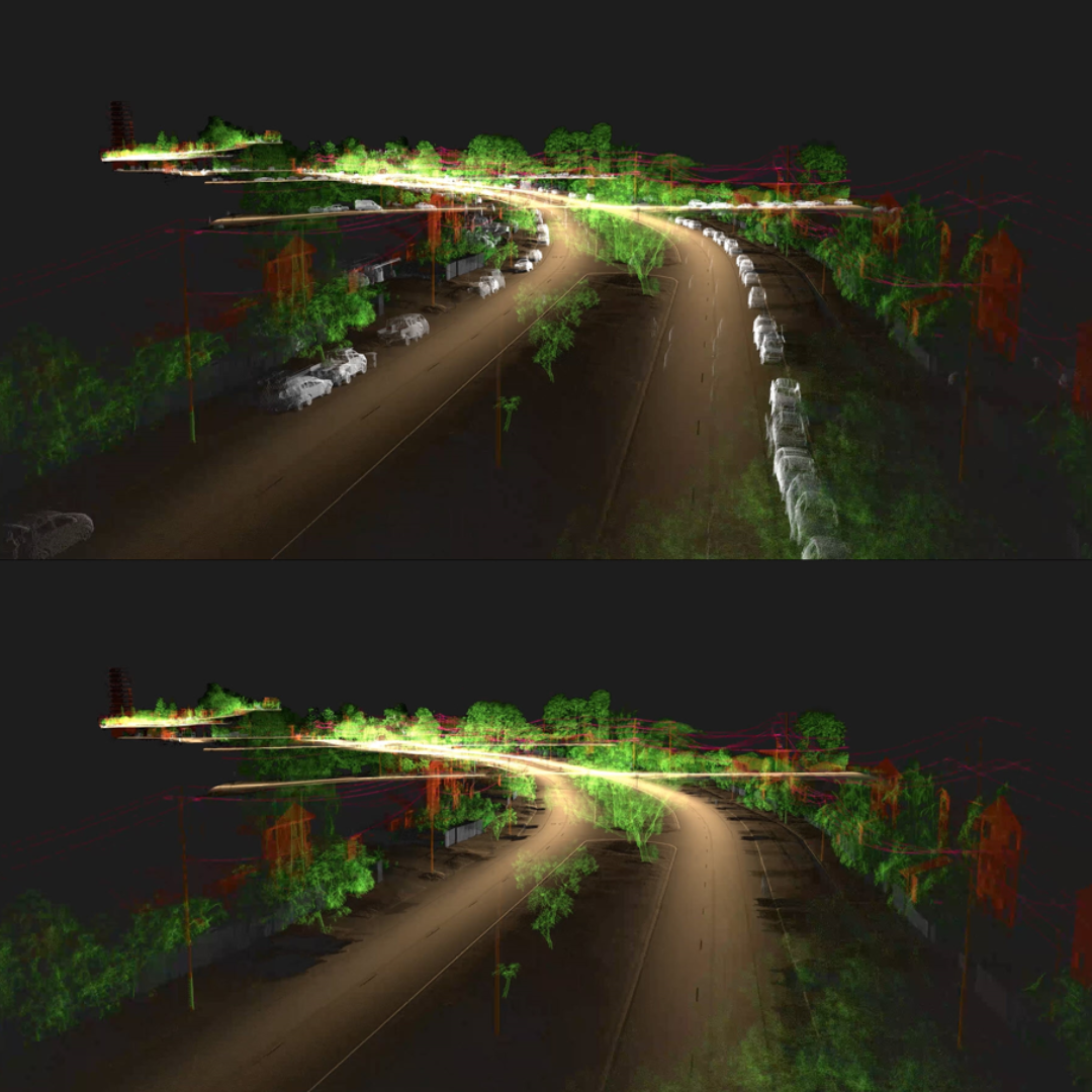
- Stage 2 – Point Cloud Refinement: We apply AI again - this time to identify and remove vehicles directly from the point cloud. This leaves us with clean, high-quality spatial data, free from transient obstructions.
The outcome? A significantly improved deliverable for our clients, with cleaner visuals and more accurate models - without compromising data integrity.
AI is not just a buzzword - it’s helping us raise the bar in spatial data quality and automation.